Affiliate disclosure: This post contains affiliate links. If you use them, I may earn a small commission at no extra cost to you. Thanks for your support.
This beginner-friendly trail is the city’s most famous, offering panoramic views of the South China Sea, lush hills, and a smooth path perfect for all levels.
In this guide, you’ll find the trail map, duration, starting point, and tips to make your Dragon’s Back Hike unforgettable.
Dragon’s Back Trail Overview: Distance, Difficulty & Highlights

The Dragon’s Back Hike in Hong Kong is a 12 km trail known for its panoramic sea views, green hills, and dramatic cliffs.
The route is easy, well-marked, and beginner-friendly, so you don’t need to worry about getting lost.
It’s the perfect choice if you’re short on time but want to experience Hong Kong’s natural side.
Map: Trail to Follow
On the map above in “Details,” you can download the route in KML or GPX and use it in Maps.me or another application.
You can use it without an internet connection while you walk.
How to Get to Dragon’s Back
The Dragon’s Back trailhead is in Shek O Country Park, on the south side of Hong Kong Island.
- By MTR: Take the subway to Shau Kei Wan Station.
- By bus: From the station, hop on minibus 9 and get off at To Tei Wan stop — right at the trail entrance.
- End point: The hike finishes near Chai Wan MTR Station, so it’s easy to return to the city.
Tip: Grab a coffee or pastry at the 7-Eleven or bakery by Shau Kei Wan before you start. The bus drivers are friendly — ours even waited while we bought breakfast!
Join a Guided Dragon’s Back Hiking Tour
If you prefer not to worry about transport or navigation, you can book a Dragon’s Back Hiking Tour.
These guided hikes include transfers, local tips, and make your day stress-free while enjoying one of Hong Kong’s most scenic trails.
Tips for Hiking the Dragon’s Back Trail
Bring an Octopus card for easy travel on the metro and buses. Carry enough water, since there are no fountains along the way.
In summer, start early, wear a cap or hat, and be prepared for little shade. There are bathrooms at the start and near the end of the hike.
The trail takes approximately 3–4 hours, depending on your pace and the number of photo stops.
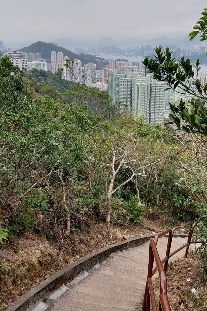
Start of the Dragon’s Back Hike
We began our hike on a sunny February day with a pleasant 18°C, few crowds, and a relaxed atmosphere.
Along the way, we crossed paths with groups of hikers of all ages, all enjoying the nature and greeting one another.
The trail starts with a staircase and quickly rewards you with impressive views of Tai Tam Bay and the Stanley Peninsula.
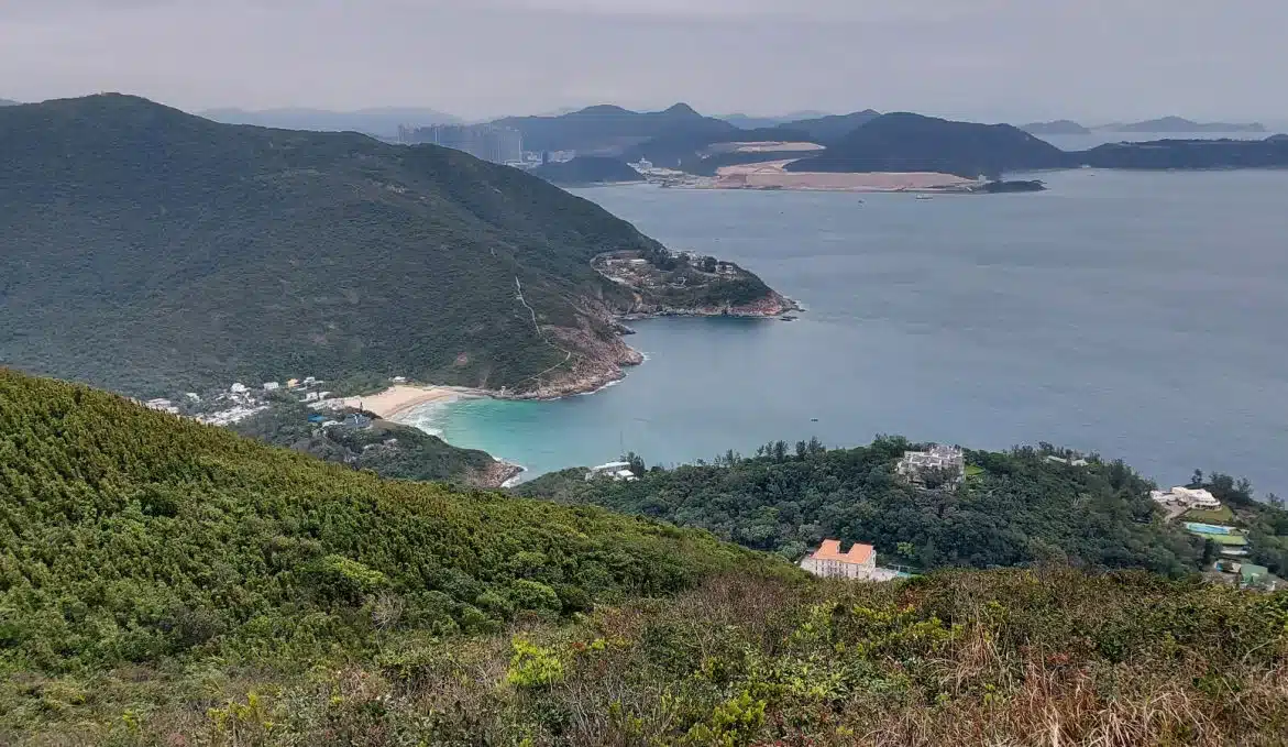
First Viewpoint on Dragon’s Back Hike, Hong Kong

After about 1.5 km, the trail reaches its first viewpoint — a cliff overlooking Hong Kong Island and the South China Sea.
The contrast between the city skyline and the endless blue horizon makes the Dragon’s Back Hike Hong Kong unforgettable from the very start.
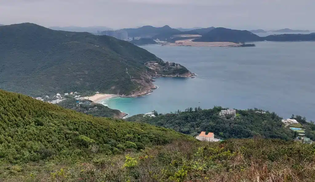
Walking Along the Ridge

From the first viewpoint, the path continues along the ridge of Dragon’s Back, where viewpoints appear one after another.
Each offers a fresh perspective of the Pacific Ocean framed by lush trees and bushes.
The scenery may seem constant, but the ridge gradually reveals new angles until the trail begins its final descent.
Dragon’s Back Hike – Panoramic Views Over Shek O Peninsula
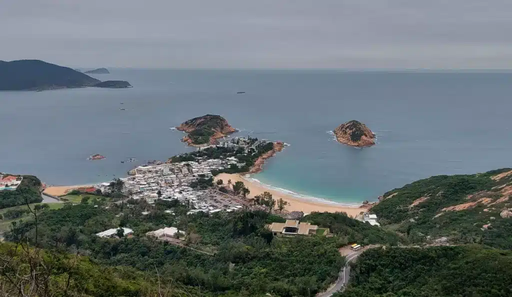
As you continue, you will come to a junction with a small rest area and a few signs. Follow the “Dragon’s Back” sign at the top of the stairs.
Keep going, don’t give up! The view will be worth all your effort when you reach the point with the unique rock formations and a breathtaking panoramic view of the Shek O peninsula.
Path to Pottinger Peak or Big Wave Bay
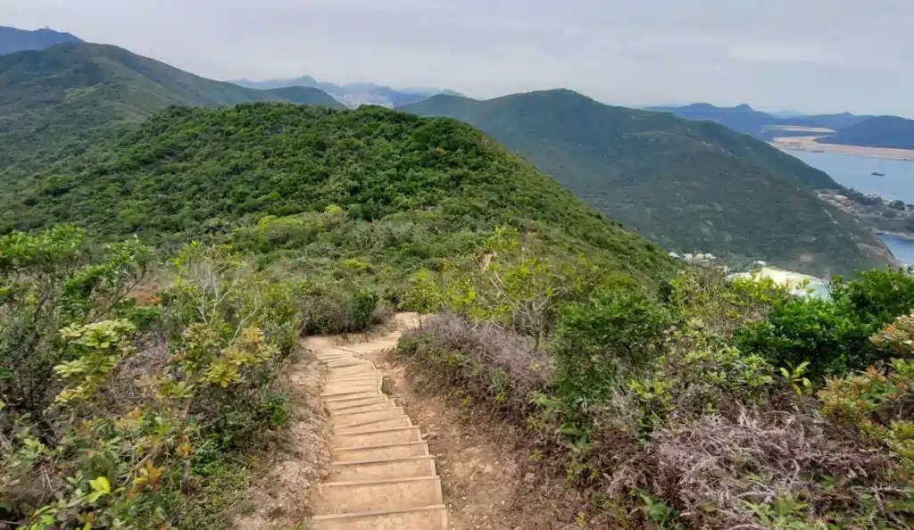
From here, you can continue the Dragon’s Back Hike Hong Kong either towards Big Wave Bay or Pottinger Peak.
The views fade briefly as the trail enters the forest, but both options lead to unforgettable scenery, making for a perfect way to end the hike.
Pottinger Peak

Dragon Back Hike
Named after Henry Pottinger, Hong Kong’s first British governor, the peak offers sweeping views of Hong Kong Island.
From the top, you’ll see skyscrapers on one side and the vast Cape Collinson Chinese Permanent Cemetery on the other — a striking contrast that makes this hike so unique.
Descent to the MTR Station
Dragon Back Hike
The final stretch takes you down towards Chai Wan MTR Station, following the sign for “Chai Wan via Cape Collinson Road”.
From here, it’s easy to head back to central Hong Kong and finish your Dragon’s Back adventure.
How to End the Dragon’s Back Hike Hong Kong – Route to MTR Station

The final section of the Dragon’s Back Hike in Hong Kong includes a pedestrian crossing with escalators, a modern shortcut that makes the descent quicker and easier.
From there, a shaded path leads you directly to Chai Wan MTR Station in just a few minutes — the perfect way to wrap up your adventure before heading back into the city.
Plan Your Dragon’s Back Adventure
Whether you hike on your own or join a guided Dragon’s Back tour, this trail is one of the most rewarding outdoor experiences in Hong Kong.
With its mix of ocean views, forest paths, and the chance to finish at Big Wave Bay, it’s the perfect way to add nature to your trip.
Dragon’s Back Hike – FAQ
Yes, the Dragon’s Back trail is well-marked and considered beginner-friendly. We even saw many older hikers enjoying the route. The only challenges are a few stairs and short, steep sections. Avoid risky moves near cliffs — it’s not worth a selfie!
This hike is perfect for nature lovers and anyone wanting a quick escape from the city. Easy access and stunning views make it one of the most popular trails in Hong Kong.
Yes! The trail ends at Big Wave Bay, a small beach known for surfing. After the hike, you can relax on the sand, swim in summer, or grab a snack by the shore.
The Dragon’s Back Hike in Hong Kong is about 12 km long and usually takes 3–4 hours, depending on your pace and photo stops.
The Dragon’s Back Hike in Hong Kong is rated easy to moderate. The trail has some stairs and short climbs, but overall it’s beginner-friendly. Most people in average shape can complete it without problems.
The best months are October to March, when the weather is cooler and less humid. In summer, temperatures and sun exposure can be intense, so it’s better to start early in the morning.
Take the MTR to Shau Kei Wan Station, then catch bus 9 to the To Tei Wan stop — right at the trailhead. The hike ends near Chai Wan Station, making the return easy.
Related Hikes & Nature Guides
- Lion Rock Hike in Hong Kong – Another iconic trail with panoramic views over Kowloon and Victoria Harbour.
- The Charming City of Gyeongju in South Korea – Explore history and scenic walks in Korea’s ancient capital.
- Nature in Singapore: Fort Canning Park – A green escape in the heart of the city, perfect for a stroll.
Pin this post